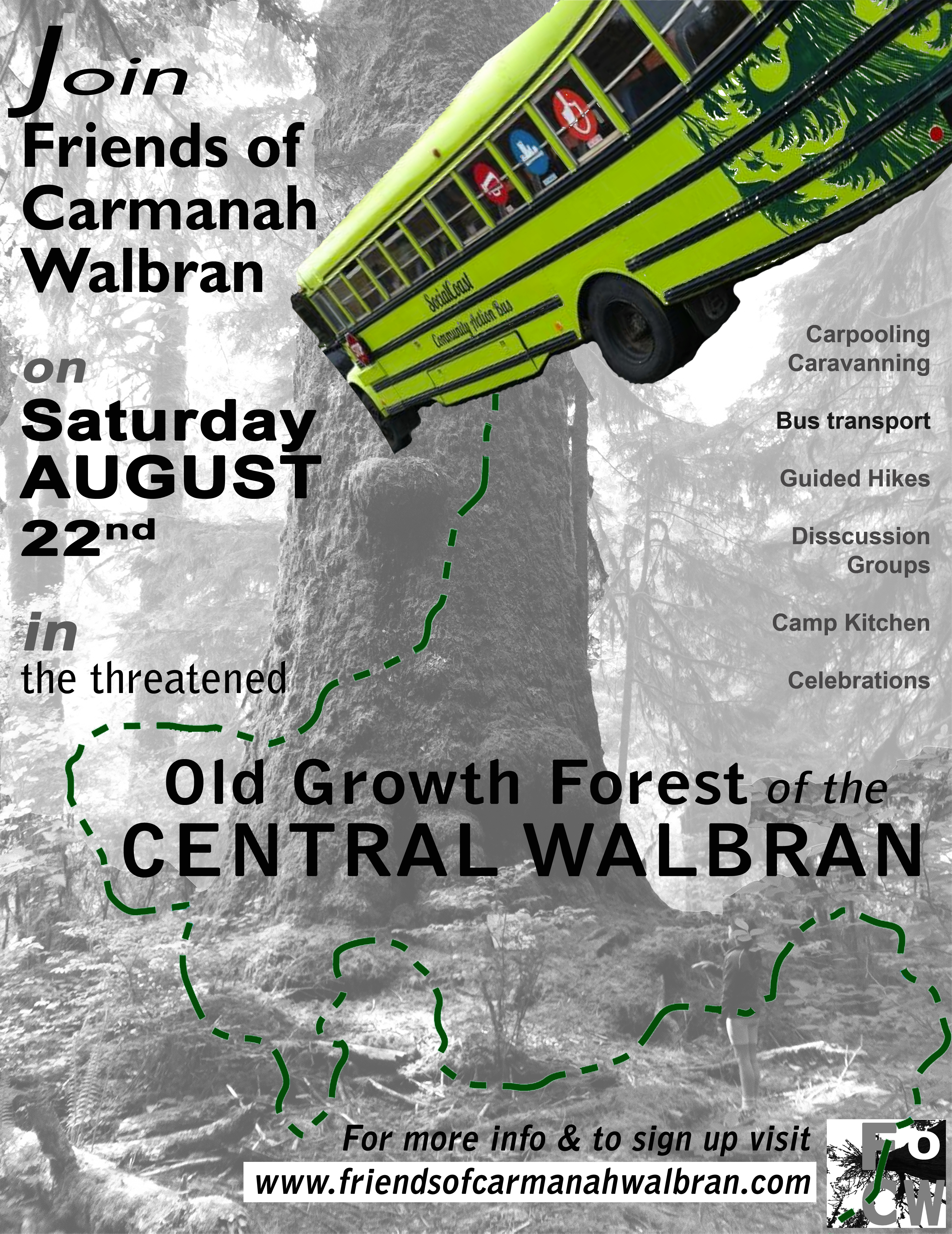
Ongoing Improvements

11406668_10152957070246009_4841111140487096542_oA new noticeboard for visitor information was built this weekend!  All that is left is a little roof before it rains. It has the Wilderness Committee map and some of their cards and also some our flyers. There was a group of hikers who came later on Sunday who took cards and flyers, it works!!! Weather was so hot and buggy but with so many flowers, Tiger Lilys, Arnica, Columbine, Canterbury Bells and many more blooming along the river.

Thanks to our wonderful and dedicated volunteers who have been improving the boardwalk and raising awareness11030784_10152957070856009_7552493108705765843_n about this precious area.

2015 Trail Maintenance Campaign Kick-off!

Boardwalk with new grips and a stable foundation

Boardwalk with new grips and a stable foundation

This past weekend marked the first time in nearly 25 years that the boardwalk and trails in Walbran Valley saw any significant maintenance and repair.  It is an impressive testament to the skills of the original builders that the boardwalk was standing at all, much less being in fairly good condition!  More than 20 of us headed up and enjoyed the breathtaking nature and beautiful trees.

So, what did we accomplish?

The Road: The road to Walbran Valley is actually maintained by logging companies, but that means that if they are not logging an area (yay!) they aren’t going to maintain the road (booo!).  Some parts of the road are quite rough and require 4-wheel drive, but the smaller potholes beyond the bridge were filled with gravel and make for a much smoother ride.

The Medicine Wheel: Although we currently do not know it’s origin, the Medicine Wheel is a a ring of rocks with a large cross in the middle that was built on a completely overgrown logging road spur.  The path and wheel were cleared off and is visible again.  I hope we discover the origin of the Wheel soon!

Medicine Wheel

Medicine Wheel, revealed!

Trail Clearing: Trail clearing has happened from time to time since the trail was built, which is the only thing that has stopped the trail from being swallowed up by the forest.  That being said, a huge amount of time was spent cutting back salal from the trail and exposing the ground.  Trail clearing is an ongoing project that will never be completed so long as the forest keeps growing, but we made good progress in this area.

Boardwalk Repairs:  Whew – this is going to be a big job, but we have started!  Thankfully, the surface much of the existing boardwalk can be preserved, although much of the foundation will need to be rebuilt/repaired.  A couple of very talented arborists were able to lend their trade skills to split cedar logs into shakes that can be used for building new boardwalk.  Additionally, one of our woodworkers and original trail builders started evaluating and repairing the trail, bit by bit.

Thanks to our trail co-ordinator for getting the supplies together, and thank you the wonderful, talented, and dedicated volunteers who used their time and skills to improve the trail!

Carmanah And Her Hereditary Guardians: A narrative account by HIS-TAH-TOO-QUAH (1992)

In July 1984 while camping with my parents Frank and Susan Knighton, my father told my wife Monique and I the story of how we, the hereditary guardians of Carmanah, came not only to own and use this place but to occupy it as the centre of our homeland.

In years gone by there was a Black Face Dance help at Tattoosh Island.  This was the permanent home of out very very long ago ancestors.  Tattoosh Island is just off Cape Flattery, the northernmost point of the Olympic Peninsula in what is known as Washington State, directly across the Straight of Juan de Fuca from Carmanah on the southwest coast of what is now known as Vancouver Island.  In those very ancient times Carmanah and other points of both sides of the waters were owned by our family and used in the cyclic pattern of the life of out people

To continue reading, please click here to download the full article.

Excerpts from Between Ports Alberni and Renfrew: Notes on West Coast Peoples by E. Y. Arima (1991)

Southeastern West Coast Place Names:

The West Coast of Vancouver Island is often thought to be oriented north and south, at least by those at a distance, but generally lies more northwest and southeast, and in the Ditidaht-Pacheedaht sector is closer to an east-west direction than north-south.  A number of place names have been recorded for the southeastern part of the West Coast from Race Rocks near Victoria to Cape Beale, the immediate informants being Charles Jones (CJ) backed by his wife Ida (IJ), Jasper Peters (JP), Joshua Edgar (JE), Bernice Touchie (BT) and John Thomas (JT) who also checked renderings.

To continue reading, please click here to download the full Southeastern West Coast Place Names pdf.

The Road Stops Here, a documentary by Velcrow Ripper (1992)

On July 4th, 1992, the B. C. government issues a cutting & roadbuilding permit to the New Zealand transnational Fletcher Challenge, ignoring its own Old Growth Strategy’s Committee’s call for a two year halt on logging in the Walbran The company began cutting roads a week before the public input deadline expired.  The public has responded with local and international demonstrations, sit-ins, hunger strikes, tree-sitting, and road blocks To view this beautiful documentary about the 1992 efforts to protect the Walbran valley, please click here.